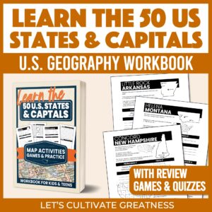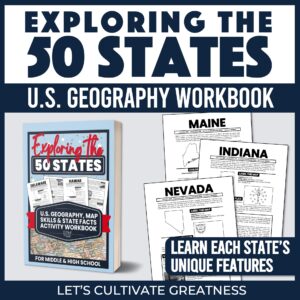
United States Geography Through Maps Workbook
$14.95
Build Real Map-Reading Skills with 36 High-Interest Maps—Perfect for Grades 7 and up!
Available in PDF or paperback format.
Description
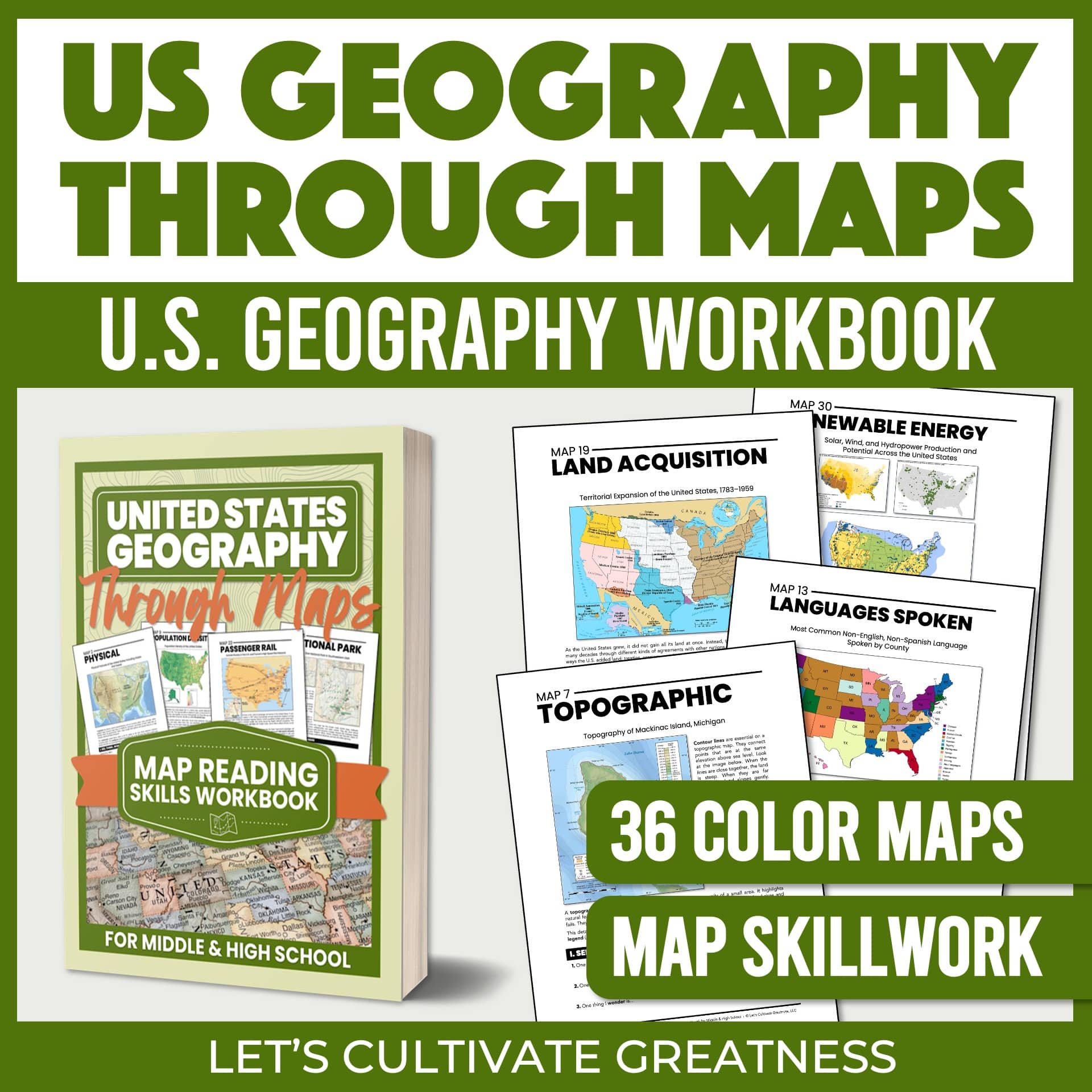
Geography is more than memorizing capitals or coloring maps. United States Geography Through Maps helps students truly understand how maps work—while learning about the physical, cultural, economic, and historical features of the United States.
Through 36 full-color maps and guided activities, students move from observing to analyzing to interpreting information—building meaningful map-reading confidence week by week.
Designed for middle school and high school learners, this workbook is ideal for homeschool families, classroom teachers, and independent learners who want real, practical geography skills—not busywork.
Why Homeschoolers and Teachers Love This Workbook
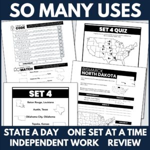
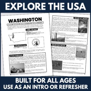
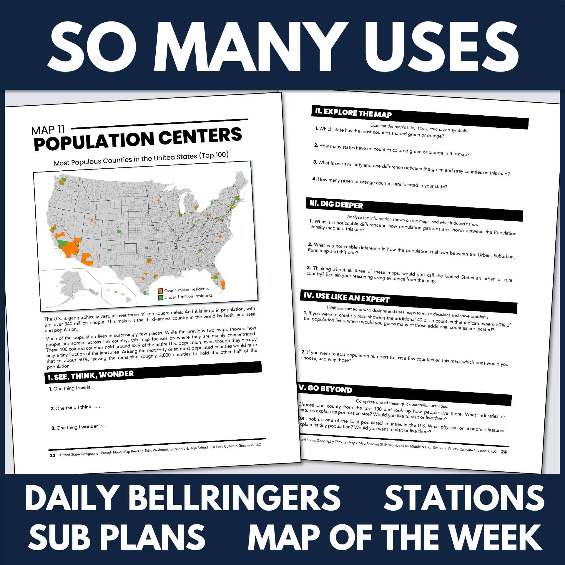
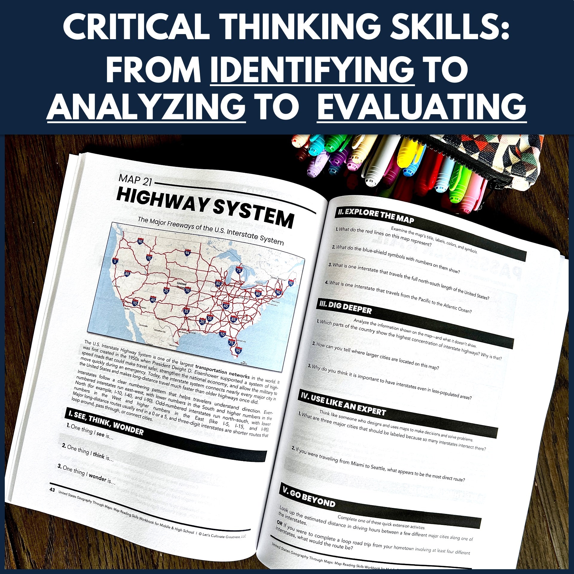
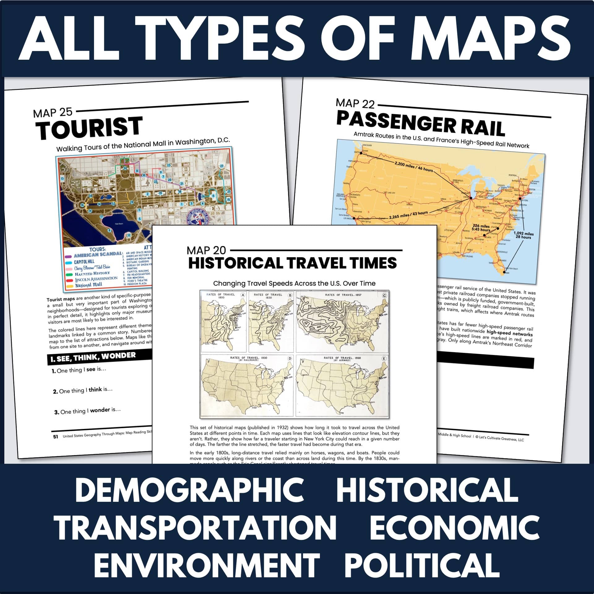
- Authentic map-reading practice using political, physical, climate, population, transportation, and historical maps
- Clear explanations of key map vocabulary such as scale, legends, symbols, coordinates, and regions
- Five structured activities per map that build skills step-by-step from identifying features to thinking like a geographer
- Critical-thinking questions that ask students to infer, compare, connect ideas, and evaluate how maps communicate information
- Open-and-go format—no prep required for parents or teachers
- One-map-per-week structure that fits perfectly into a 36-week school year
This Workbook is Perfect For
- Homeschool families seeking an easy way to both learn essential geography content and strengthen critical thinking skills
- Teachers who want ready-to-use resources to enrich their U.S. history or geography classes
- Independent learners looking to learn about how U.S. history and geography affect present-day issues
Inside You’ll Find
- 36 full-color maps covering U.S. political, physical, economic, environmental, and cultural geography
- Five daily activities per map, perfect for an easy one-a-day routine
- Practice with essential geography concepts—latitude/longitude, regions, population density, climate zones, physical features, transportation routes, land use, and more
- Map vocabulary and skills practice woven throughout every lesson
- Extension ideas for deeper exploration with each map
- Answer keys for all map activities
This resource is 81 pages. It’s available as either a PDF digital download and a paperback (on Amazon).
What grades is this intended for?
This was designed to work for a wide range of ages, from upper elementary through high school.
What formats does this come in? Can I modify this?
This workbook is available in two versions: a PDF file that’s available for instant download from the LCG website and as a print paperback through Amazon. Neither are editable.
What skills does this workbook practice?
Several! The activities in this workbook address:
- Exploring the unique physical and human features of the United States
- Making connections between an environment, history, and the ways people live and work
- Reading and interpreting maps using scale, direction, symbols, and legends
- Using maps and other visuals to understand how places are connected
- Conducting research to answer questions and build real-world information-gathering skills
- Comparing regions and concluding about similarities and differences across the United States
What are the terms of use for this resource?
This resource, including all ancillary files, may be used as needed for regular, non-commercial single-classroom or homeschool use between a teacher/parent and their student(s).
This includes printing copies and sharing digital files with students through a secure platform, like Google Classroom or Canvas, email, or a classroom-only shared drive.
The using and sharing of any part of this resource in any manner outside the above-mentioned capacity is strictly prohibited. Prohibited uses include, but are not limited to,
- posting files on the open internet or in a Facebook group
- emailing files to or sharing print copies with others (without purchasing additional licenses)
- uploading or storing files in a shared cloud drive accessible by anyone other than students
- including any part, or any derivative work, within any commercial endeavor like curriculum development, professional training, or for-profit teaching like Outschool, or selling this resource as your own in either print or digital formats
Doing so violates the Digital Millennium Copyright Act (DMCA), copyright law, and these terms.
By downloading this resource from Let’s Cultivate Greatness, the original user has been granted one license for a single teacher (or number of teachers matching the number of licenses purchased) and their students at any one time.
Let’s Cultivate Greatness retains the full copyright of this resource.
This amazing workbook features 36 maps that cover political maps, Congressional Districts, and much, much more. I have been looking for a way to incorporate more review and learning opportunities about the geography of the United States in my U.S. History classes. I find a number of students have not had enough opportunity to learn geography, and I am very happy that this book will now provide me with the tools I need to do so.
A description/explanation accompanies each map: its type and use, and in addition, the workbook includes comprehension questions, so my students and I both know if they have made progress in their learning of geography. The activities are what I have been looking for. I have already started incorporating these map skills into my U.S. History class - it is just GREAT!. – Sister Hedwig
As a middle school Social Studies teacher, I am always looking for engaging ways to teach important—but not always exciting—skills. This workbook includes several excellent map activities, and the moment I saw them I thought, “This is exactly what I’ve been looking for.”
I was especially excited about Maps 15 and 16, which focus on Native America. I have already set them aside to use. Quality resources for this topic can be surprisingly hard to find, and the map of Indigenous tribes paired with thoughtful questions was exactly what I needed.
The resource is well-designed, classroom-ready, and absolutely worth the price for the time and quality it provides. While I will likely use this resource in a more piecemeal way rather than completing one map each week, it is easy to see how it could be incorporated into a weekly routine as well. – Cady