Researching and learning about the 50 states is almost a rite of passage, usually in elementary school. Students pick a state, look up a few facts, color in the flag, and report on the state bird and tree. But it leaves so much to be desired.
If you want to do something more meaningful with your learners, you’re in the right spot. In this post, I’m sharing a more intentional way to teach the 50 states—one that focuses on geography, connections, and thinking skills instead of surface-level “fun” facts.
If you’re looking for a range of supports in teaching U.S. geography, be sure to check out this overview post of my U.S. geography curriculum resources here.
The Problem with So Many State Research Activities
Many state research projects focus on trivial facts like state animals and exact population counts, and pre-made resources often rely heavily on word searches and coloring pages. These often leave students learning very little that’s meaningful about the state itself, and even in elementary grades, students are more than capable of deeper skill work.
Older students also benefit when that research emphasizes cross-disciplinary connections among geography, economics, and history, and how place shapes people and communities over time.
A Skill-Based Approach to Learning the 50 States
When students learn about the 50 states, what really matters is helping them understand place—where a state is, what the land is like, how people live there, and why it developed the way it did.
First, students need to be able to locate the state on a map, identify the capital and major cities, and notice key land features and landmarks. This gives them a framework to make sense of new information.
From there, they’re ready to dive deeper into a state’s culture, economy, natural resources, or historical events. This is what helps answer the bigger question of what this place is known for—and why.
When students return to their maps to add details or make notes, they begin building a mental picture rather than just completing an assignment. The framework (state and city names, location on a map, etc.) and the deeper content work together, so learning sticks with circular reinforcement.
Just one example is how Kansas sits in the middle of the Great Plains, an area that’s prone to tornadoes. That’s why Kansas and its neighbors have tornado-specific building requirements, why it makes sense that a tornado plays a prominent part in The Wizard of Oz, and why many sports teams in the area have storm-related names.
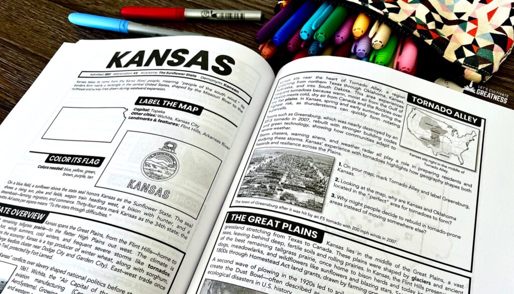
Imagine spending even a few minutes learning about that instead of coloring in Kansas’s state bird or memorizing its motto!
This is also where real skill-building happens. Students are practicing analyzing information, making connections, and forming ideas—all core critical thinking skills.
When learning about the 50 states is structured this way, it feels purposeful rather than overwhelming or, worse, boring. Students come away with a clearer understanding of how geography shapes people, economies, and history—and that’s what makes state study actually stick.
What I Recommend for Teaching About the 50 States
This circular approach—examine a map, learn a few specific meaningful place-based facts, connect back to the map—is essential for helping students build a clear picture of each state and understand why it matters. This is especially true for older students, but even elementary-aged kids aren’t too young to grasp and retain the information when it is learned this way.
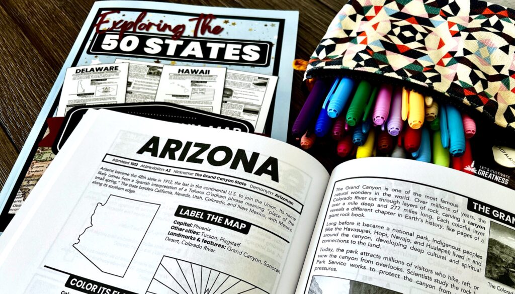
And this is exactly how I built my workbook, Exploring the 50 States. Each state gets a two-page spread covering the basics, along with two high-interest spotlight topics and related critical thinking questions.
I intentionally designed this book to be open-and-go and work with a range of ages, from upper elementary through even high school.
For families who want to spend more time with each state, I also include optional extension ideas. Some of my favorites include exploring food and music tied to a state—by creating a playlist or making a traditional recipe—or visiting a state’s official tourism website to see what images and places it highlights.
These ideas, along with many others, are listed in the workbook so families and teachers can choose what fits their time, goals, and interest level.
Check out my flip-through video below to see a bit more inside.