Reading maps is one of those skills we tend to assume students will have naturally. Perhaps it’s because the thinking is, “well… you just look at them.”
But maps do much more than show locations. They’re packed with information, patterns, and clues that require critical thinking, interpretation, and inference. While maps are inviting and accessible, they’re also surprisingly complex.
That’s what makes maps such powerful tools in social studies. Often, the same map can be viewed by a range of thinking levels, making it great for a mixed-abilities class or for teaching content family-style in your homeschool journey.
In this post, I’m sharing the most essential map types to teach, why map-reading skills matter in social studies and everyday life, my best strategies for teaching them, and my favorite resource for doing so.
If you’re looking for a range of supports in teaching map skills and U.S. geography, be sure to check out this overview post of my U.S. geography curriculum resources here.
What are Map-Reading Skills (and Why are They Important)?
Map-reading skills go far beyond knowing where something is located. At their core, they’re about understanding what information maps communicate and using that information to make sense of the world.
Basic map-reading skills include reading titles and legends, understanding scale, and identifying relative location. These foundational skills are typically introduced in upper elementary grades.
But as students get older, they also need to learn how to understand thematic maps. These are maps that display information such as population patterns, economic activity, climate, and historical change—the kinds of maps middle and high school students encounter most often.
These types of maps appear everywhere in social studies. Students will see them in geography units, history or civics textbooks, and news stories. When students can’t understand a map independently, their learning is limited.
Maps also appear in everyday life—subway maps, tourist maps, topographic maps, and more. Knowing how to read them is a practical life skill, not just an academic one.
On a deeper level, strong map-reading skills help students spot patterns, make comparisons, and draw conclusions. Maps naturally invite questions like: Where was the trail built here? Why does this state specialize in the industries it does? Why is this region struggling while these others are thriving?
That kind of thinking is exactly what social studies is meant to develop—and maps are one of the most powerful tools for getting there.
Most Essential Types of Maps Students Should Learn to Read
A map isn’t just a map—there are many kinds of maps, and they all work a little differently. And students need exposure to a wide range of map types year after year, including increasingly complex ones. That’s because different maps answer different kinds of questions.
Here are the most important kinds of maps students should learn to read, especially in middle and high school:
Physical and topographic maps are often where map skills begin. These maps show landforms, elevation, bodies of water, and natural features. They help students understand how the physical landscape influences human behavior, such as settlement and economic activity. Without this foundation, it’s hard for students to fully grasp why places developed the way they did.
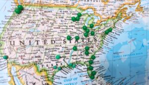
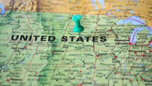
Political maps are familiar to most students, but they’re often underused. Beyond identifying borders, political maps help students understand relationships between places and how boundaries affect history. These maps are especially important when studying history, civics, or economics.
Transportation and tourist maps are some of the most practical—and engaging—maps students can practice with. These include road, transit, and visitor maps that highlight landmarks and routes. These real-world maps help students think about movement and decision-making while also teaching practical life skills they’ll use directly outside of school.
Population and thematic data maps are where higher-level thinking really comes into play. These maps display information about population, economic activity, climate patterns, migration, or natural resources. Learning to interpret these maps helps students analyze data, identify patterns, and draw conclusions—skills essential to history, economics, and current events.
When students regularly work with a variety of map types, they stop seeing maps as just something to look at and start seeing them as tools for understanding information.
Best Strategies to Build Map-Reading Skills Into Your Classroom
The great thing about maps is that they’re easy to weave into almost any social studies topic—and they’re easy to find once you start looking for them. Teaching map-reading skills effectively doesn’t require a separate unit; it works best when maps are used regularly and intentionally. Here are my favorite ways to make maps a core part of a classroom or homeschool routine.
1. Look for maps to explore regularly.
This sounds obvious, but it does require intention. For whatever topic your students or child is studying, start asking: What maps or data visualizations exist for this topic? Look in textbooks, curriculum materials, or online.
A simple trick is to search your topic plus the word “map” in Google Images. You’ll be surprised at what turns up.
For example, if you search “Martin Luther King Jr. map,” you’ll find maps showing:
- Cities across the U.S. that have streets named after him
- Important places he traveled to during the Civil Rights Movement
- When and how states recognized Martin Luther King Day
- A National Park Service map of the Martin Luther King, Jr. National Historic Park
Since that’s not a topic most people associate with map analysis, it really shows how maps can and do connect to any topic.
A few reliable places to find interesting maps:
- Our World in Data and World Mapper for global thematic maps
- The U.S. Census Bureau for U.S. demographics data and maps (however, these maps can be pretty complex)
- Simon Show You Maps is one of my favorite social media accounts for sharing maps. I’m sure there are more; just make sure their sources are credible.
2. Start at the surface before going deeper.
Before analyzing anything, take a minute to simply look at the map. Notice the title, legend, colors, and symbols. Then move on to spotting patterns, making comparisons, and identifying anything that stands out.
Only after that should students start asking questions, making guesses, and drawing conclusions. Even young students can do this kind of layered thinking when it’s modeled in the right order.
3. Use the MAGIC method to analyze maps.
A memorable way to teach map analysis is the MAGIC method, which also works well for graphs and charts.
- M – Main title: What information is this map showing?
- A – Attributes & Author: What do the colors or symbols mean? If it’s a graph, what are each axis labeled with? Who created the map, and where did the data come from? Is it trustworthy?
- G – General Trends: What seems to be happening overall? Summarize this up in a single sentence.
- I – Inferences: What might be the reason(s) for the trends you see? What might explain outliers or exceptions? This step is all about making educated guesses.
- C – Conclusion: What is the important takeaway? What’s surprising, impressive, concerning, or missing? What is this map best used for?
This structure helps students move beyond what they see to why it matters.
4. Create a map-of-the-week routine.
Besides using maps within individual lessons, consider a map-of-the-week routine. This helps students practice map-reading skills consistently without it feeling overwhelming.
Some teachers use a Maps Monday bell-ringer. Something like this lets you pick a map that connects to whatever unit you’re already covering—even for topics that don’t seem map-friendly at first, like Martin Luther King.
Regular exposure like this builds critical thinking skills over time.
A Resource to Support Ongoing Map Skill Practice
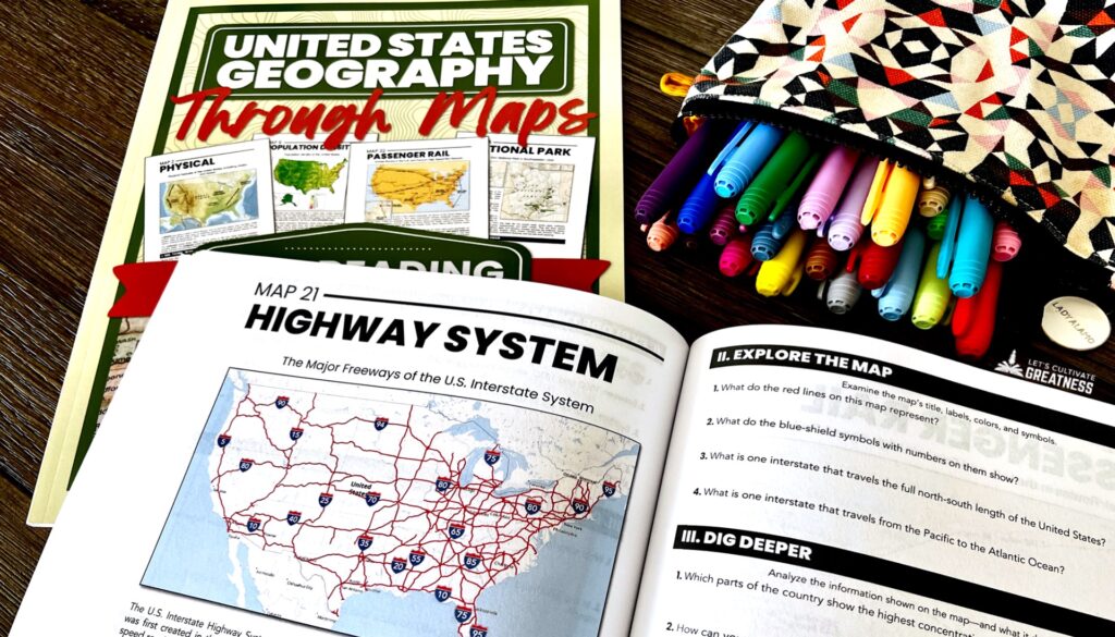
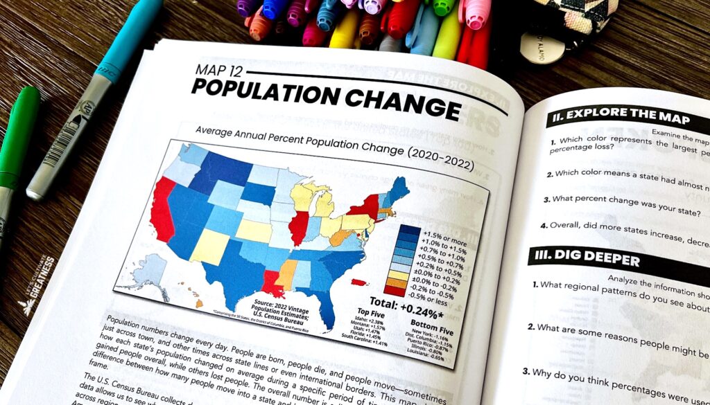
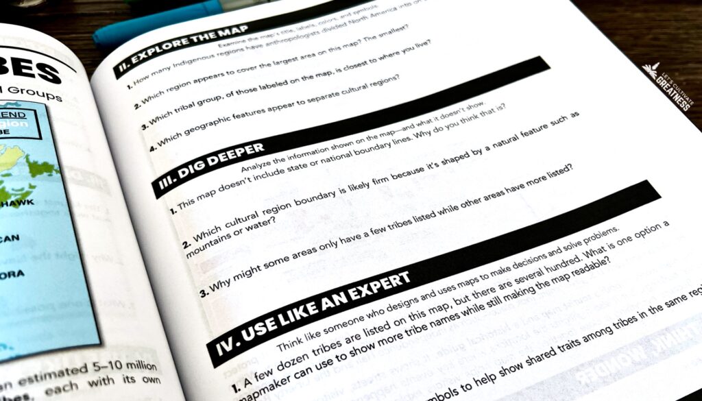
If you like the idea of consistently building map-reading skills, my United States Geography Through Maps workbook was designed with that exact goal in mind.
It’s built around 36 carefully selected maps, making it perfect for a map-of-the-week routine. Each map comes with short activities that move students from surface-level to deeper thinking—reading the map, spotting patterns, making comparisons, and drawing conclusions.
I included a wide variety of political, physical, transportation, and thematic maps of the United States, making it perfect for use in a middle or high school U.S. geography or history class or a homeschool routine.
Whether you use one map a week or pull specific maps to match a unit you’re already teaching, it’s designed to fit in easily –with clear directions, intentional skill practice, and no extra prep work for you.
Check out my flip-through video below to see a bit more inside.